

Remote Intelligence was proud to lead the first session ever about UAV’s at the PA GIS Conference 2015 in State College, Pa. This technology is of ever increasing importance in the GIS industry, as well as many other industries. Co-founder and partner, Rob Schwarz, talked about the basics of UAV’s, the current FAA standards and ways to get authorized, and how to incorporate data from UAV’s into a GIS workflow. The session was well attended and generated much discussion throughout the conference and keynote presentations. Remote Intelligence looks forward to its leadership in the UAV/GIS future and how they can assist local and state government, and private industry, with incorporating such technology into their GIS.
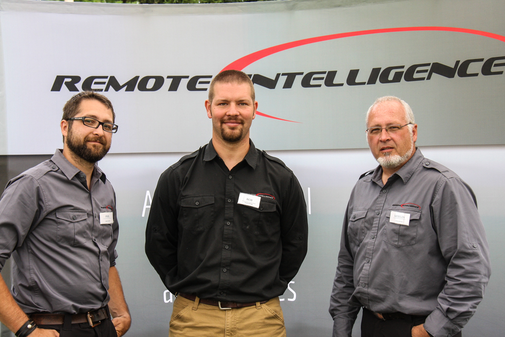
What makes RI who we are?
Recently Remote Intelligence had the opportunity to apply for a some grant funding via Mission Main Street, from Chase. The application asked some fantastic questions. We thought we'd take the opportunity to share some of these answers with you.
1. Tell us about your business and what makes it unique. Please provide a general description of your product, customers, competitive landscape, and overall performance.
Remote Intelligence, LLC, is a small business in rural Pennsylvania that focuses its talents in wildlife biology, management, and conservation mapping with the use of Unmanned Aerial Systems (UAS or Drones). To utilize these systems we have invested in sophisticated equipment, computers, mapping software, marketing materials, and hiring an operations tech. We desire to continue to expand on our rapport of performing safe missions while delivering quality mapping and imagery. We help clients improve Ecosystem Conservation Services by providing 3D topographic mapping, wildlife density surveys, habitat monitoring, wetland surveys, agricultural crop surveys, etc. We assist the Conservation in Energy Development industry by performing mapping and surveys that help determine where NOT to develop, saving habitat and species that are sensitive. Our clients are diverse, ranging from energy developers and engineers to tourism promotion agencies and conservation non-profits. Our competition is minimal presently, but this is a growth market. Some traditional mapping and engineering firms are experimenting with adding unmanned aerial services to their offerings, but the required investment in equipment, software, and experience favors a firm such as ours focused on this technology to provide the services in a safe and quality manner.
2. What inspired you to become an entrepreneur? Describe both your greatest achievements and biggest challenges.
I (Phil) have always been fascinated in technology helping people. Growing up in rural Pennsylvania, I was greatly inspired by my father, who owned a small construction company and later a general store. He was able to provide for our family while also serving the community. This demonstrated the value of community-minded small businesses and inspired me to start my own. Our partners have been testing and using drones for over 10 years, and creating other successful startups (Wildlife Specialists, Tioga Window Washing, Steward Green). As Remote Intelligence, we pioneered estimating deer and other large mammal densities with UAS-based thermal imaging to inform wildlife biologists and community planners working to reduce vehicular collisions or diseases, and support habitat conservation. We also mapped sensitive wildlife habitats like Bald Eagle or American Alligator nests with minimal disturbance. In the energy development field RI has provided useful project mapping and monitoring services, and we are working with our clients and university partners to integrate new sensors and technology to address more of their needs efficiently and safely. We have been challenged by identifying equipment and processes to provide reliable and safe results at higher-quality and more economically than traditional techniques.
3. How is your business involved with the community you serve? Examples include: giving back to the community, sourcing locally, and/or contributing to economic development via hiring.
Remote Intelligence has helped the community of Wellsboro in Tioga County, PA in a number of ways. Upon request, we have investigated natural disasters such as floods to assist in emergency response. RI has demonstrated thermal imaging to simulate snowmobile search and rescues in the mountainous wild, another tool to aid in a real life situation locally. We hire and train local residents with interest and potential in a new tech industry; this is important in our rural farming community that has been depressed economically. We provide discounted imaging services to the county Visitors Bureau and local businesses to highlight the region’s recreational features and attract visitors for economic development. We teach classes on operating drones safely, speak to school and community groups, and perform demonstrations for little or no charge. Our mapping missions help to conserve the natural environment in this region so dependent on the ecology of the area. Remote Intelligence has supported student projects at Cedarville University as an investment in the future. We are forming a non-profit to channel a portion of our proceeds, and UAS services, to areas of need worldwide for humanitarian efforts.
4. What would a $100,000 grant mean to your business and how will you utilize the funds? Please be as specific as possible.
Remote Intelligence has recently completed Phase I of our growth plan, hired limited staff (partners have been donating their time), bought military grade professional drone systems, developed our services, applied for a Section 333 Exemption from FAA, and secured our first several clients in diverse sectors, with a strong emphasis in the energy development field. Our next phase of growth requires us to produce quality mapping, thermal imaging, and other specialized surveys for larger clients who have expressed a desire to work with us. In order to meet their needs, we need to hire more staff, integrate more drones with specialized optics, and purchase more software licenses. The FAA will also soon introduce regulations to ensure operational safety of UAS. While we welcome the regulations, we also need to prepare for compliance. Specifically we need to complete instruction for 2-3 pilots’ licenses. We need to add employees (4-6), new UA Systems (3),a LIDAR sensor, a Gas leak sensor, an Agricultural Crop Soil sensor, and additional licenses for our preferred mapping software. These funds would position us to move into a sustainable level, from which we could grow and expand our services and impact.
5. What are your short-term (1-2 years) and long-term growth plans for the business? How will this grant contribute to your plan?
For the next 12-18 months this grant would greatly increase our ability to remain loyal to our growth plan, our clients, our employees, and the community by allowing us to continue to grow and train others in this growing industry while providing the services currently being requested by our clients. Currently we do not have the funding necessary to make this “leap” that needs to happen in the next couple of months, transitioning from a startup to a sustainable operation. In our longer term plan we intend to expand operations nationally and internationally, yet keep our home base in rural Pennsylvania where we have started. Future plans include working across the US and globally, especially in 3rd world countries such as Liberia (we have meetings there next month) to create systems that can deliver blood samples and medical supplies to and from remote areas that desperately need this service. We also plan to develop a disaster response team that can be mobilized globally to aid in emergency response needs. We have begun and plan to continue to support teaching programs in colleges and universities, to encourage students to join us in this high tech industry as pilots, operators, and entrepreneurs.
Waste Management Winter Rally
It's always a pleasure to help our friends over at Wellsboro Home Page cover some great news events in the area and recently we had the pleasure of providing aerial video for the Waste Management Winter Rally. You can see the video here...
Winter in the PA Grand Canyon
Sometimes a little perspective change is all it takes to really get a new view of something beautiful. The PA Grand Canyon is in our back yard at Remote Intelligence, and working together with the Tioga County Visitors Bureau we've had the pleasure of bringing you some great shots from snowy north central Pennsylvania. Enjoy!
New Technology, New Possibilities
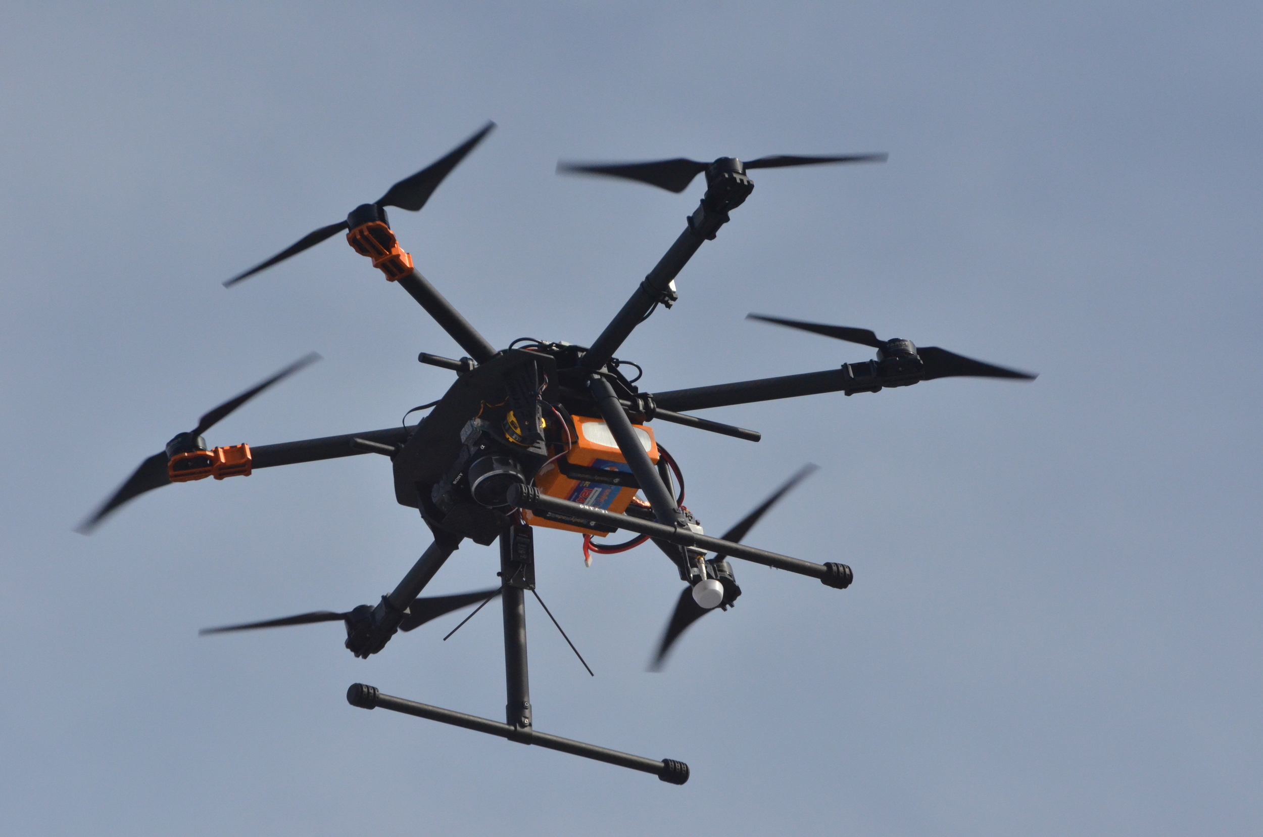
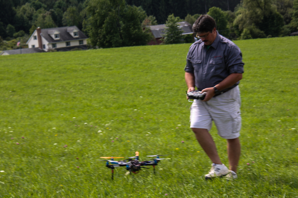
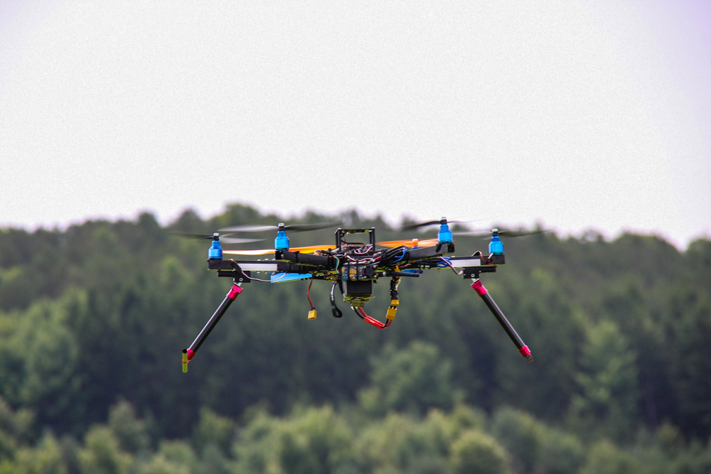
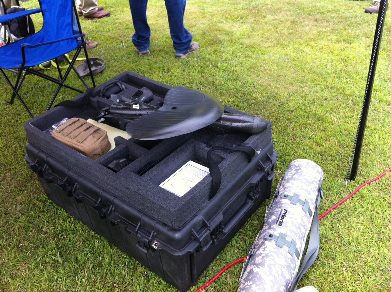
Recently Remote Intelligence took possession of our newest Hexacopter from Prioria Robotics. This is a serious workhorse with incredible flexibility when it comes to payloads and projects. We have already been able to get mapping missions coming in with greater than 1cm resolution on ground!

Search and Rescue
Search and Rescue is just one of the sectors that benefit from using Unmanned Aerial Systems, this video demonstrates some of the flexibility of the thermal units that can be rapidly deployed from almost anywhere.
Education and Partnership
Just as in our everyday lives, companies live in the realm of relationships. We are always thankful when one of those relationships gets to take the form of partnering with higher education institutions to use this exciting technology to train up the next generation of workers. Cederville University in Ohio has become one such partnership that we've thoroughly enjoyed building into.
Recently one of our partners packed up our UAS's and helped out some of the geology and geoscience students with their senior projects. Click HERE to read the story courtesy of Xenia Gazette.
One of our key values is education and we look forward to using the tools and knowledge we've gained to propel the industry forward.
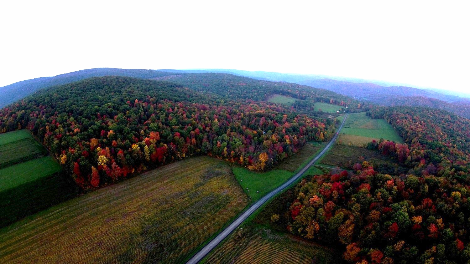
Fall
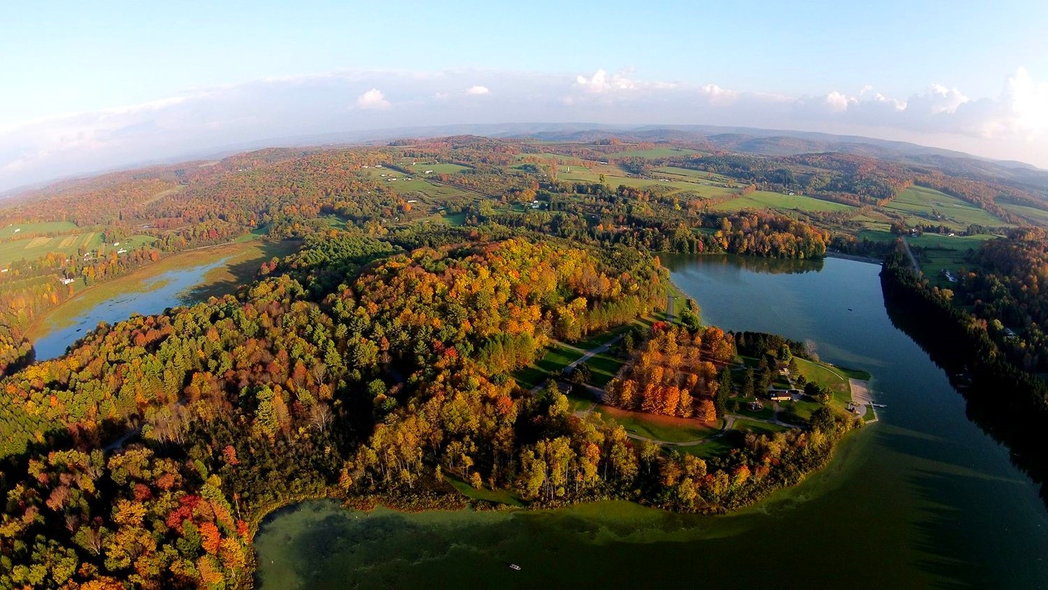
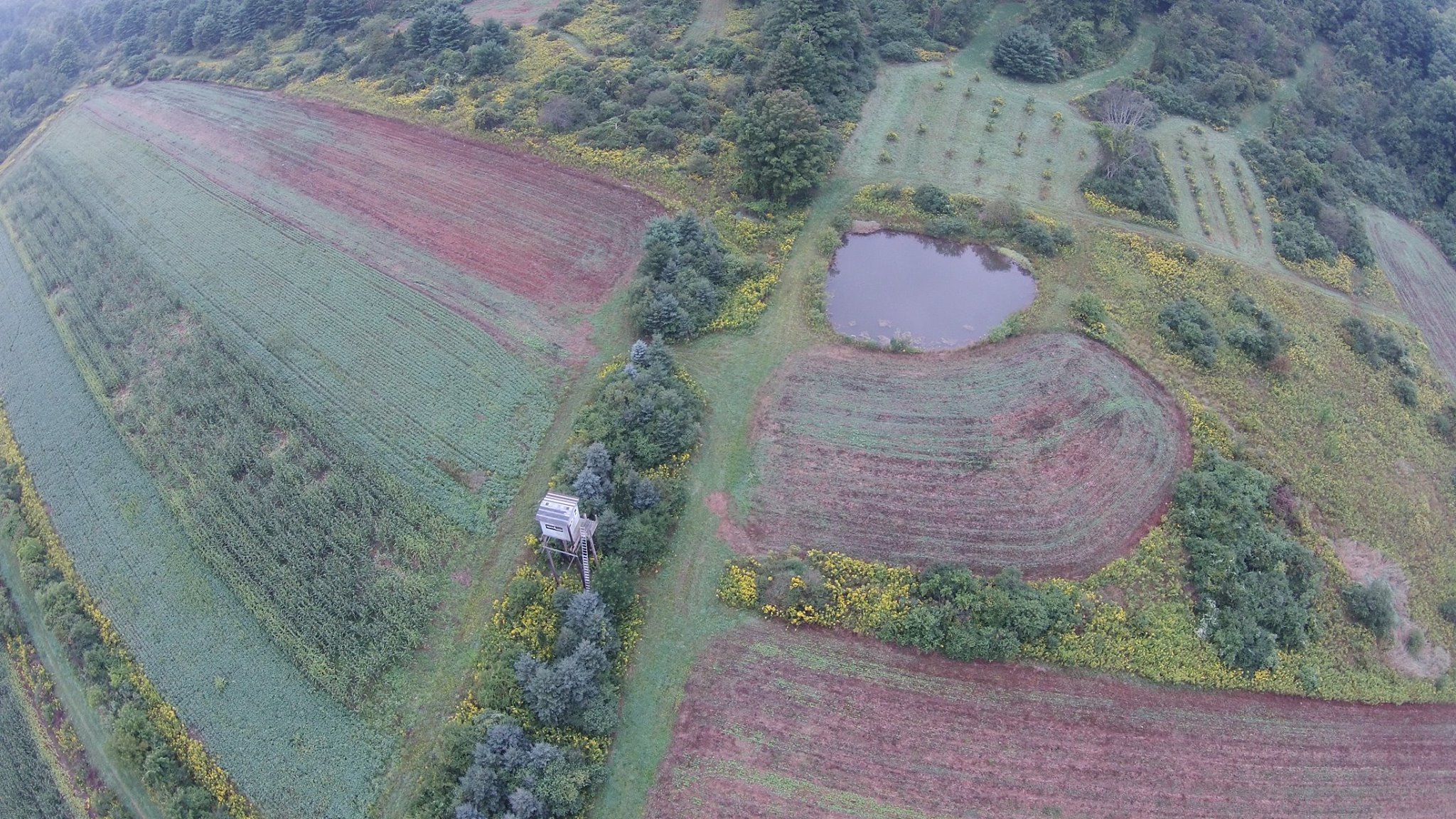
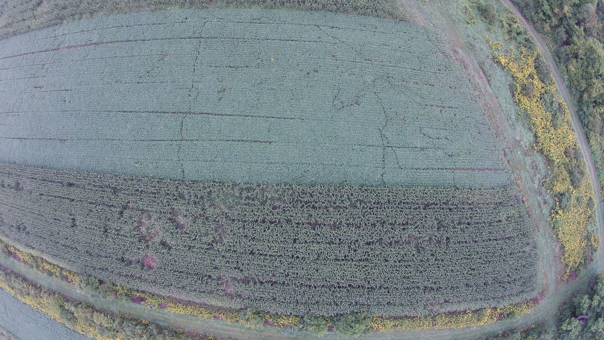
With the beauty of North Central Pennsylvania on full display, Fall is a great season to be in the air. The northern hardwoods (Oaks, Maples, and various other deciduous species) put on a beautiful symphony of color throughout the "Endless Mountain Region". Here are a few of our favorite shots, and some samples of mosaic property mapping done during this near perfect season. Please contact us if you have interest in high quality aerial photos, video or mapping during this season.
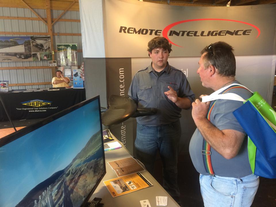
Shale Insight 2014
As the industry continues to develop for the use of UAS's on US soil we find it critical to seek out strategic opportunities to share this exciting new technology with corporations and individuals. The Shale Insight 2014 Conference, just wrapped up and we had the pleasure of co-operating a booth with one of our favorite companies Wildlife Specialists. It was a great opportunity to meet with leaders in the industry and introduce the use of highly efficient, quickly deployable, extremely precise UAS's for up to date mapping and site services.
The team did a great job of educating, inspiring, and making excellent new contacts with many of the key people in this exciting industry.
Precision Agriculture
As tech sweeps through every aspect of our lives farmers have become one of the biggest users of state of the art advances in monitoring crops and land conditions. A big piece of that process is utilizing Unmanned Aerial Systems to get instant eyes on large tracts of land.
Whether tracking animal damage and travel paths, watching crop yield, or just simply getting a true measure of their topography, this technology can give an unprecedented overview of what is happening on the land they own or manage.
New Service: Golf Course 3D model generation
One of the great new applications we've found for our systems and the software we use is 3D model terrain generation. One of the largest markets for the use of this type of technology is something that millions of people do each day... play GOLF. We are now able to offer golf course owners and managers the ability to have a three dimensional interactive course flyover, so that interested clients can tour the facility, see the elevation changes, even map out the hazards before they ever set foot in the clubhouse. Here's a little sample of a high elevation flyover from Tyoga Country Club (in Wellsboro, PA). Enjoy!
If you as a golf course or country club owner are interested in this service please contact us for package and cost information.
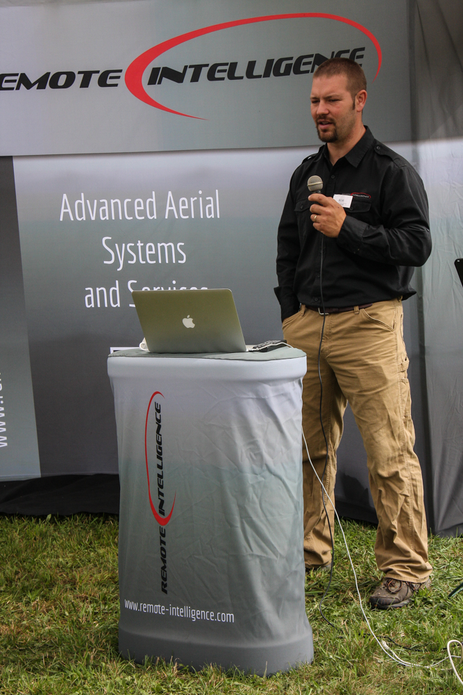
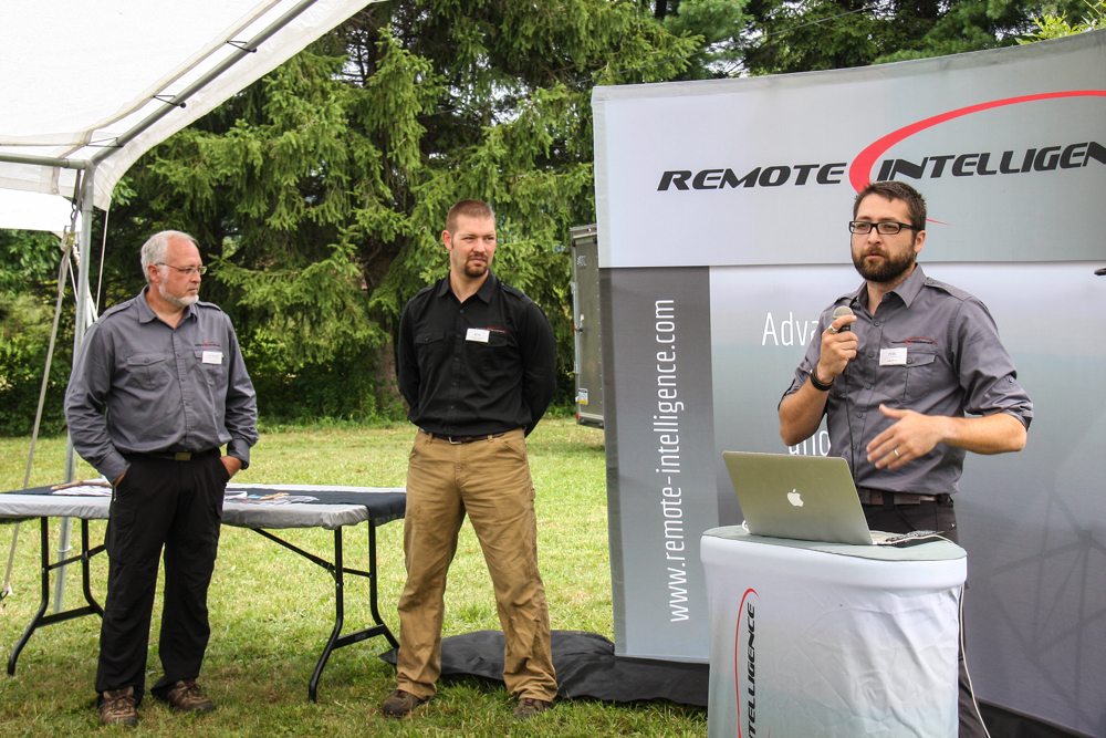
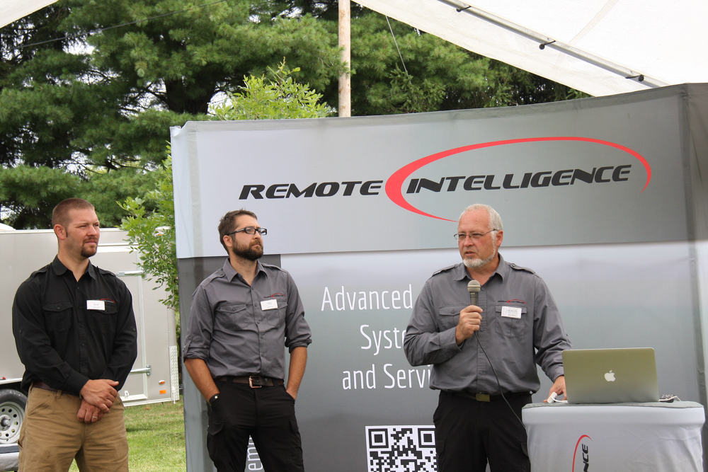
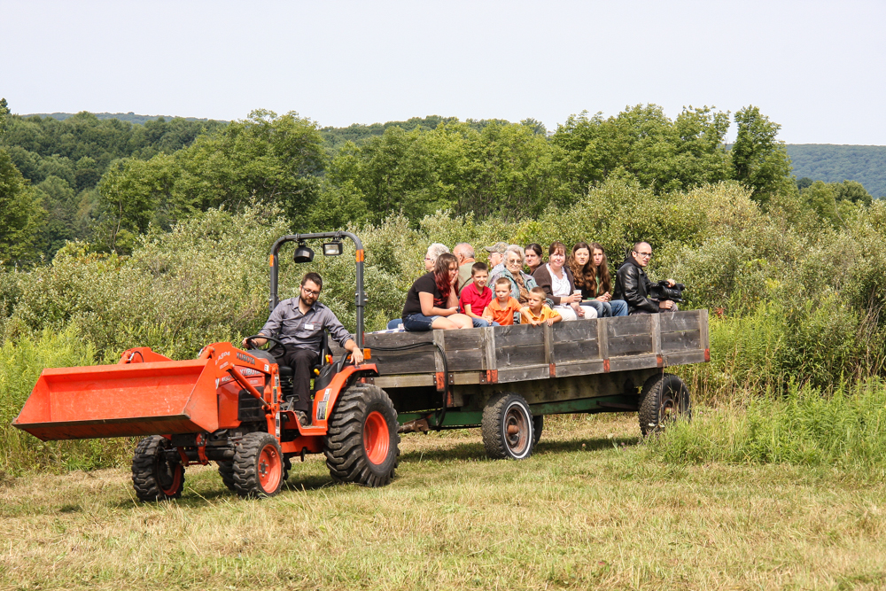
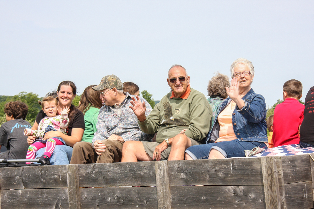
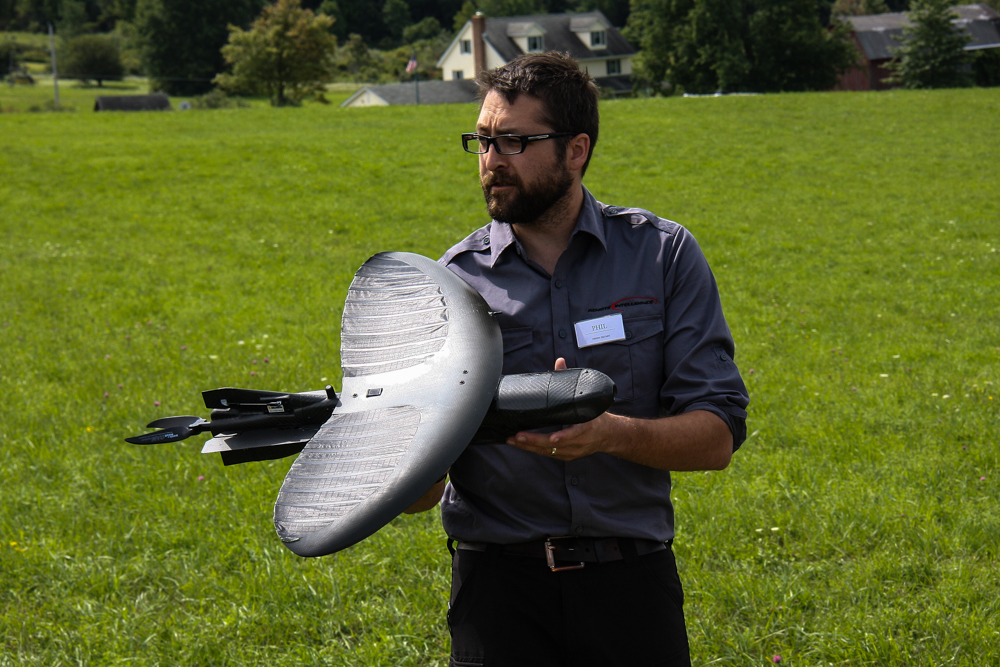
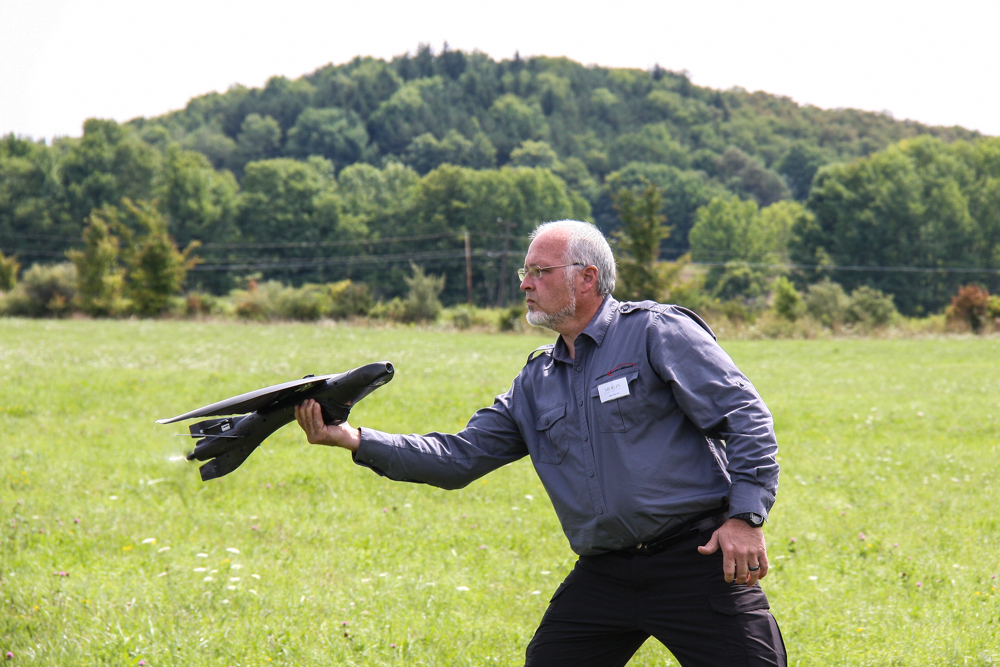
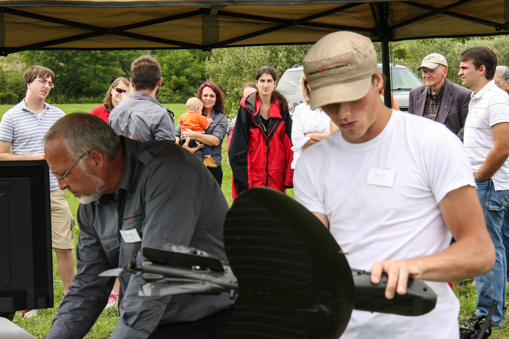
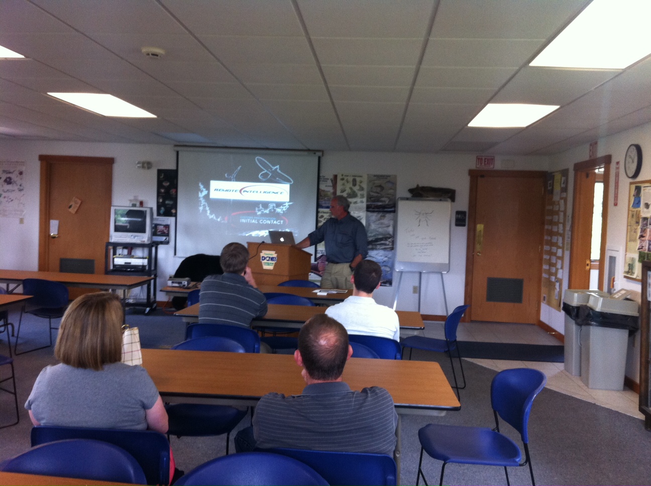
Opening our doors
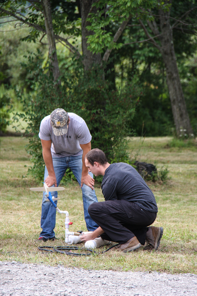
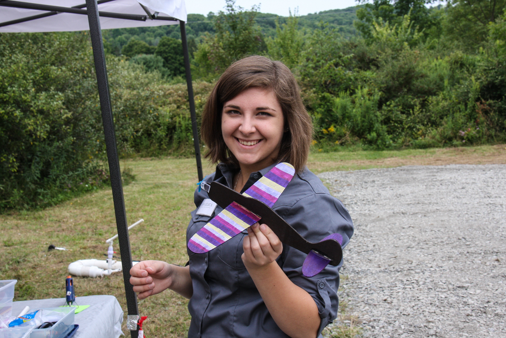
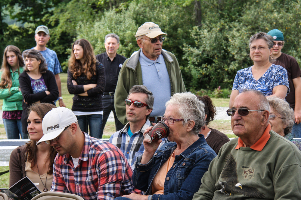
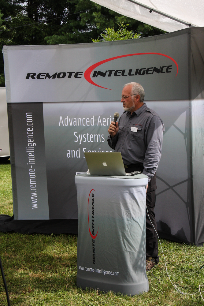
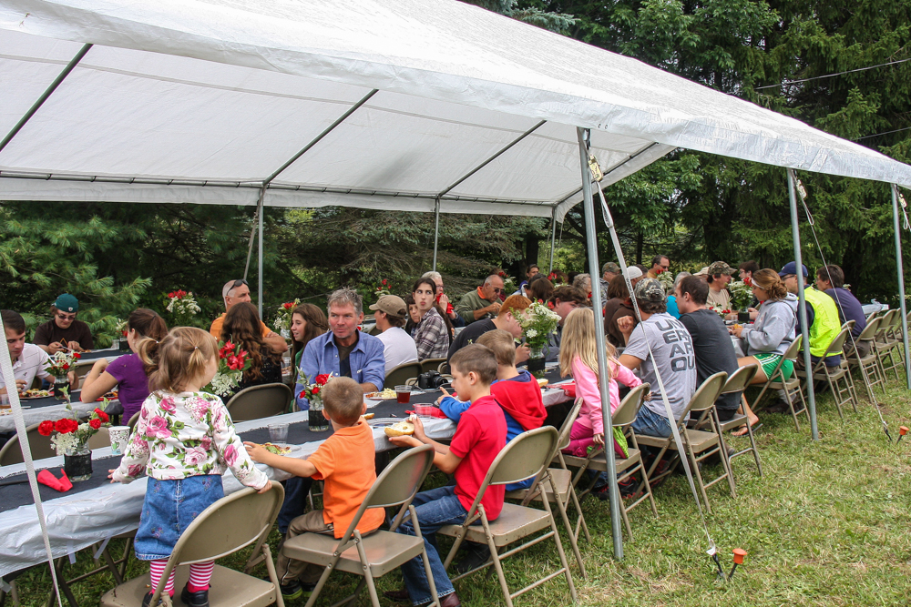
It was our pleasure to invite the community in last Saturday, August 16th for a presentation of some of the systems and services that Remote Intelligence can offer. We entertained a great showing of our clients, neighbors, family and friends! Adults enjoyed some light refreshment and system demos, as well as a bit of an education (one of our chief values) as we talked about the use and integration of UAS's in our lifetime. The kids made their own air powered rockets and colored gliders so they too could reach for the clouds.
We loaded everyone out and took them to our demo fields for a chance to see the Maveric system in action as well as a couple other little projects we've been working on. The Wellsboro Homepage was there to cover all the action and featured us on Tuesday as their headline article. Below is their video! Thanks for all who came out to celebrate, learn and dream with us!

Thanks to wellsborohomepage.com for their support, to read the whole article and to see what else is going on around the region click here.
Penn State's Ag Progress Days
We're excited to spend a few days at Penn State University's premier outdoor agricultural expo, Ag Progress Days. Our booth in the Ag Choice building gives us a chance to introduce the use of UAS's into the Ag market.
A little about the expo from their website:
"Ag Progress Days (APD), Pennsylvania's largest outdoor agricultural exposition, is held annually during three days in August and is sponsored by Penn State's College of Agricultural Sciences.
Mission
Firmly rooted in education, this 55-acre agricultural equipment exposition site features the most elaborate displays of agricultural technology and programs.
Description
With more than 480 exhibitors showcasing innovations in agricultural equipment and related industries. Featuring Penn State Extension research, educational presentations, tours and demonstrations."
Find out more here.
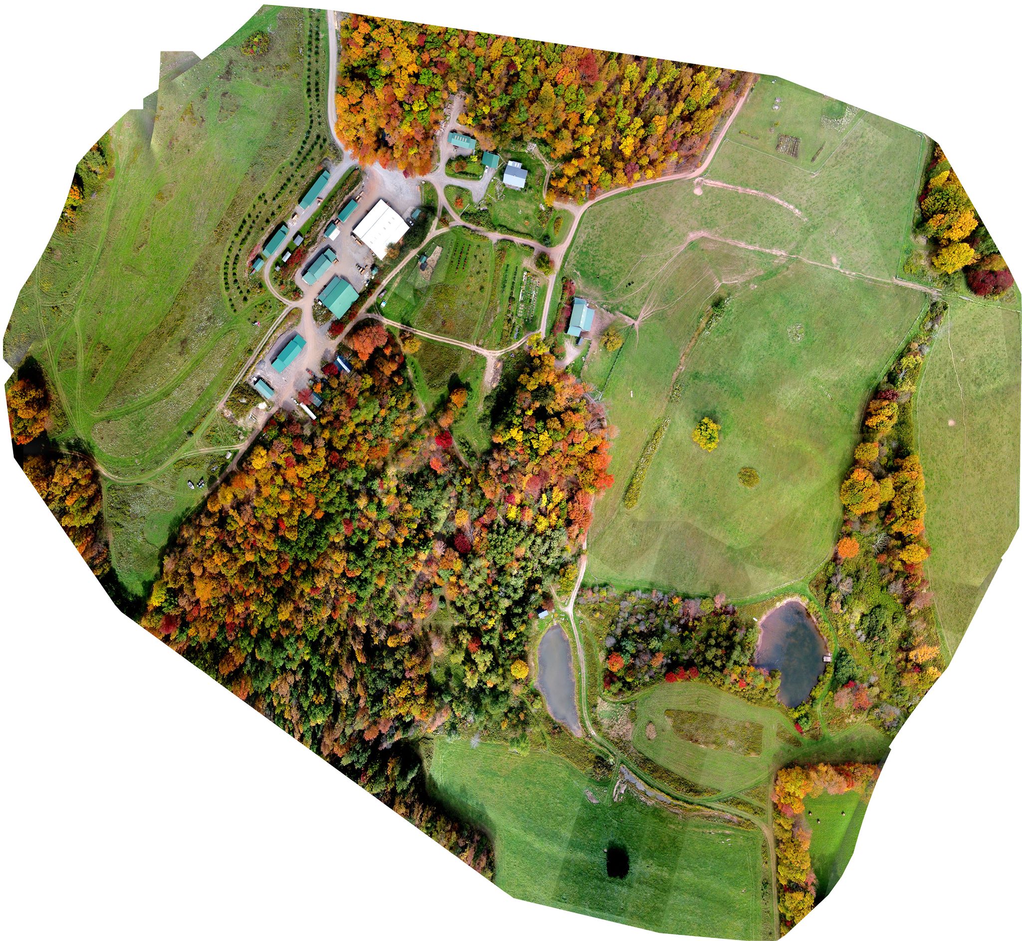
Samples: 3D Modeling Interactive Demo
This is an example of a 3D model created using our Maveric System of a valley near our offices. These models are precise and very interactive. They give the client an accurate, timely and incredibly detailed model useful in a variety of industries.
The color coding indicates the elevation of the terrain.
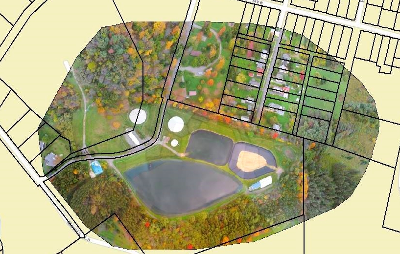
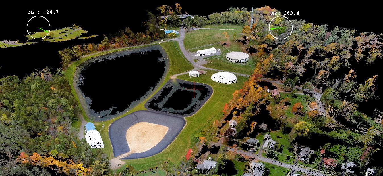
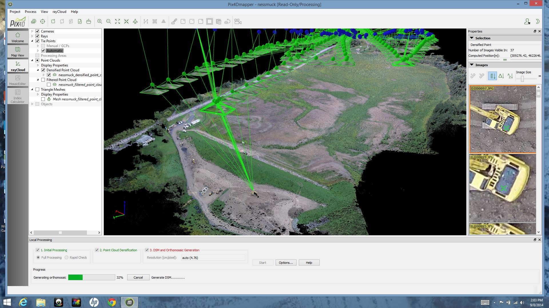
3D mapping
It's been exciting working with our professional grade systems to produce real mapping products. These screenshots were generated from a 20 minute flight of our Maveric system, and analyzed with Pix4d. They can be rotated around to view from any perspective. From this we will be generating topographic contours. All based on current photography. Remote Intelligence = Advanced Aerial Systems.
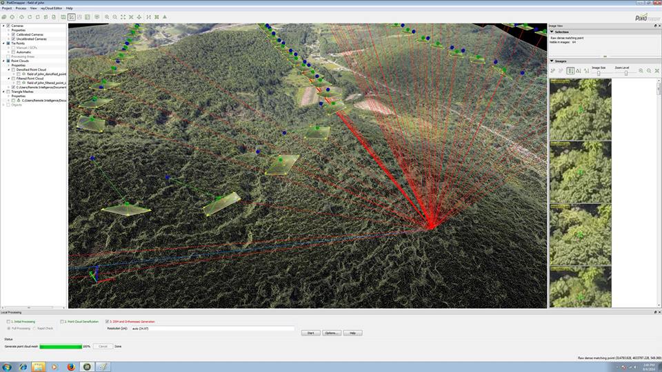
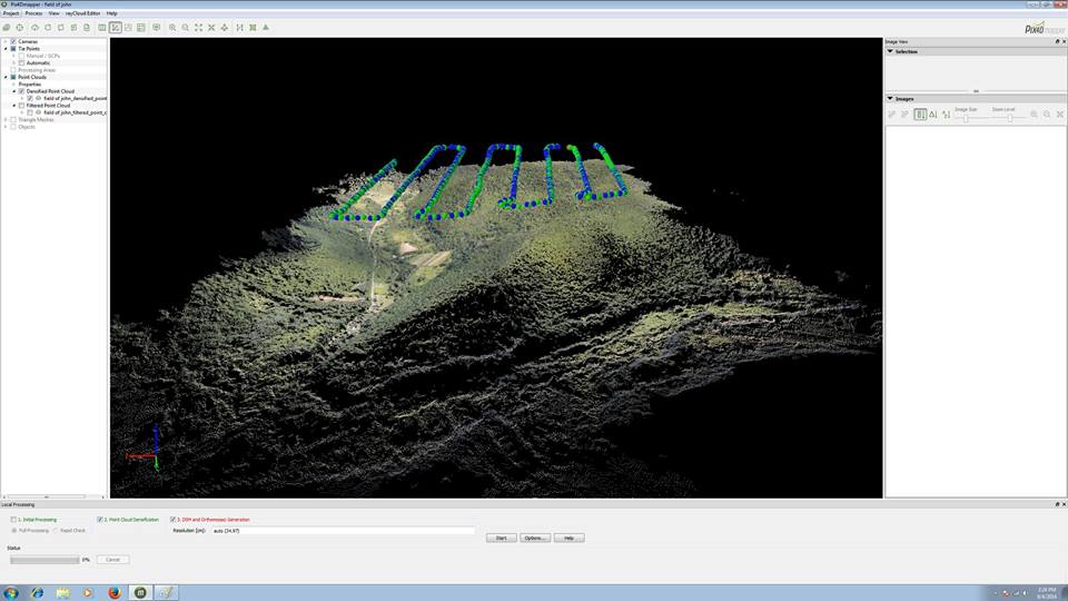
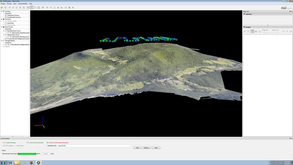
The blue and green dots represent the actual location and orientation of the Maveric during this flight.
Open House
Interested in what we've been working on? Curious about UAS's? Then you should come join us on August 16th, 2014 at our new location (953 Lake Road, Wellsboro, PA 16901) for our first annual OPEN HOUSE! As a company we strive to not only test and use these advanced aerial systems but also to educate and encourage open dialogue on the topic. If you're interested or need some directions please give us a heads up.
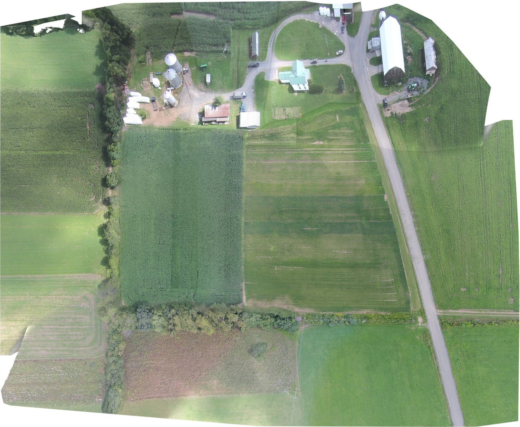
Pipeline mapping
With the addition of our premier systems like the Maveric, we are now providing professional services such as these Pipeline samples. We are continually testing the limits of this real world, professional quality, usable data reports and mapping. We look forward to bringing this technology to a host of clients in the near future.
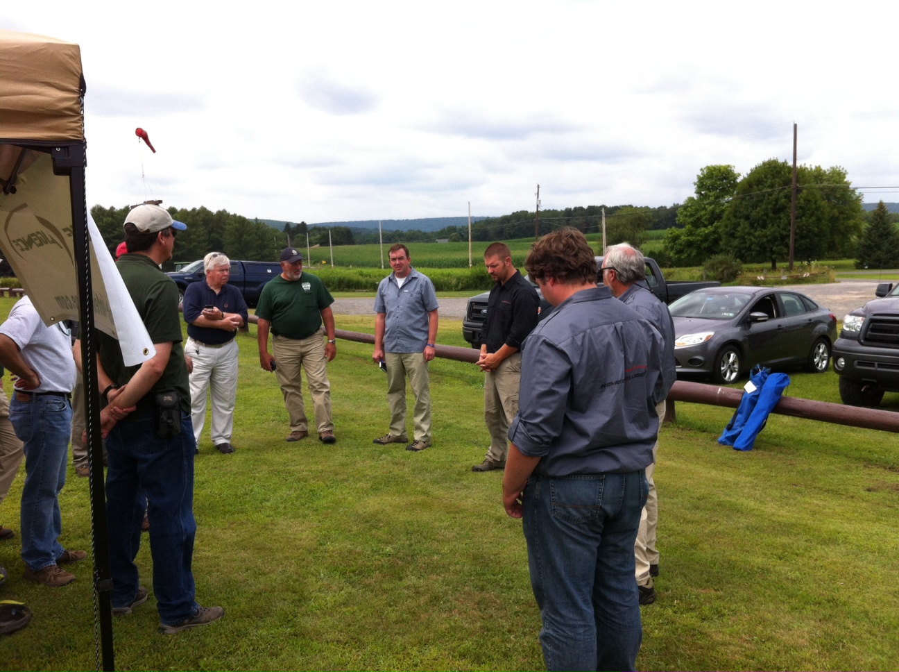
Pennsylvania DCNR Demo
We had the pleasure Monday of presenting some of the vast possibilities of UAS's to Pennsylvania's Department of Conservation of Natural Resources at Tuscarora State Park. In attendance were about 20 professionals dealing with several specialties including Wildfire Management, GIS Mapping and Pest Management. The dependability and reliability of these systems was demonstrated as these professionals in their fields got to have their minds opened to all the uses of UAS's in the forestland management category. We look forward to continuing to work with PA DCNR as exciting developments happen.

Aerial Mapping
With the addition of our Pix4D capabilities we are expanding our ability to make extremely high resolution, precise maps that are accurate within inches. With our in house GIS specialist we can make the maps you need, quickly and very accurately.

Race Footage
Since we're down in Florida for advanced training on our Maveric system, we figured we might as well have some fun! A couple of our guys headed over to the Masters of All Terrain Off-road Marathon, to give them some aerial footage of the race... here's a bit of what we captured.